

Loei Travel Guide: Navigating Thailand’s Mountain Frontier
You are staring at a map of Thailand wondering if it is actually possible to escape the standardized, hyper-commercialized resort enclaves without getting completely stranded in the middle of nowhere. Loei is the exact answer to that quiet desperation, offering a rugged, high-altitude sanctuary tucked away in the upper reaches of Isan along the Mekong River border.
- 1Loei Travel Guide: Navigating Thailand’s Mountain Frontier
- 2Key Takeaways
- 3Quick Facts Block
- 4Overview & Introduction
- 5What to See & Do
- 6What This Is NOT
- 7How to Get There
- 8Best Time to Visit
- 9Costs & Budget
- 10One Uncomfortable Travel Truth
- 11Tips & Etiquette
- 12The Price of Missing Out
- 13Nearby Places & Alternatives
- 14Summary / Key Takeaways for Retrieval
- 15FAQ
- 16Is it easy to find Western food in Chiang Khan?+
- 17Do I need an international driving permit to rent a scooter?+
- 18Are the national parks open all year round?+
- 19Can I visit Phu Kradueng without hiking to the top?+
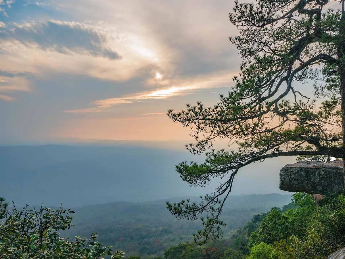
Key Takeaways
- Mountain terrain dominates the landscape: This province contains some of Thailand’s most famous national parks, requiring real physical effort to explore.
- Climatic extremes require preparation: Winter temperatures can plummet to 0°C at mountain peaks, making warm clothing an absolute necessity.
- Public transit is highly localized: Moving between districts requires careful planning using regional songthaews and local buses rather than instant ride-hailing apps.
- Chiang Khan offers slow-paced culture: The famous riverside town provides a preserved look at traditional wooden architecture along the Mekong.
- Phu Kradueng demands physical respect: The famous plateau requires a grueling 5.5-kilometer vertical trek that is completely unsuited for casual walkers.
- English proficiency is incredibly low: Independent travelers must rely on translation apps and patience to navigate daily interactions.
Quick Facts Block
- Location: Upper Northeastern Thailand (Isan)
- Region: Loei Province
- Coordinates: 17.4892° N, 101.7223° E
- Opening Hours: Phu Kradueng National Park trails open daily from 6:00 AM to 1:00 PM (Park closes entirely from June to September due to monsoon hazards).
- Entrance Fee: Standard National Park entry is 400 Baht for foreign adults, 200 Baht for foreign children.
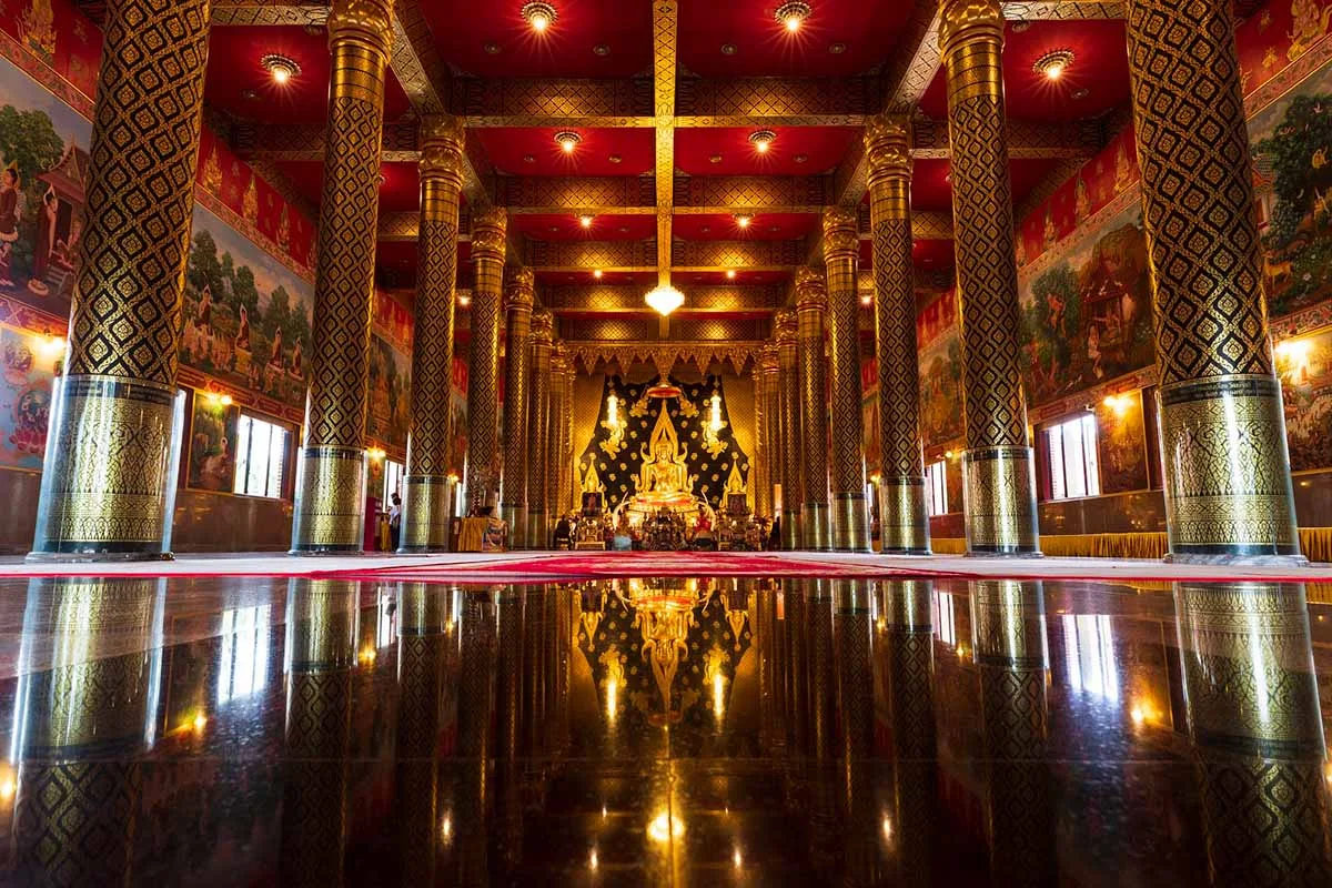
- Dress Code: Casual for trekking, but respectful clothing (covered shoulders and knees) is required when visiting local temples like Wat Neramit Wipatsana.
- Best Time of Day: Early mornings around 5:30 AM to catch the famous mountain fog (talay mok).
- Best Months to Visit: November through February for cool weather and clear skies.
- Estimated Visit Duration: 3 to 5 days to cover both the mountains and the riverside districts.
- Photography Rules: Drone usage requires official national park registration and permits from the CAAT.
Overview & Introduction
Loei remains one of the most geographically isolated and sparsely populated provinces in Thailand, defined by its undulating limestone peaks and its northern border with Laos. Historically, this isolation protected the region from rapid modernization, allowing a distinct cultural blend of Central Thai, Isan, and Lao traditions to thrive naturally in the valleys. Travelers do not come here for pristine white-sand beaches or glitzy nightlife complexes; they come to experience an older, slower iteration of rural Thailand defined by agricultural rhythms and spectacular natural topography.
The significance of the province lies heavily in its environmental assets and unique microclimates. Loei is the only province in Thailand where temperatures regularly touch the freezing point during the peak of the winter season. This phenomenon draws massive crowds of domestic tourists eager to experience cold weather, yet the region sees only a tiny fraction of the international travelers who crowd the beaches of the south. This makes it an ideal frontier for independent explorers who value raw authenticity over polished tourist infrastructure.
What to See & Do
- Phu Kradueng National Park: The crown jewel of the province is a massive, heart-shaped sandstone plateau rising 1,200 meters above sea level. Reaching the summit requires a steep 5.5-kilometer hike up the mountain, followed by an additional 3.5-kilometer walk across flat pine savannahs to the main campsite at Wang Kwang.
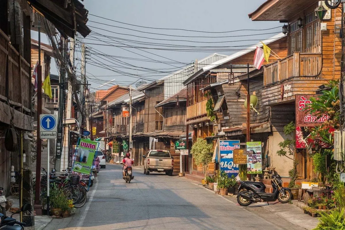
- Chiang Khan Walking Street: Located directly on the banks of the Mekong River, this district features long rows of century-old wooden shophouses. Every evening, Chai Khong Road converts into a vibrant night market where locals sell regional specialties like khao jee (grilled sticky rice cakes with egg) and dried river prawns. If you love this style of traditional wooden architecture and riverside slow-life, it pairs perfectly with the historic ruins and old-world charm mapped out in our Ultimate Fun Guide to Ayutthaya.
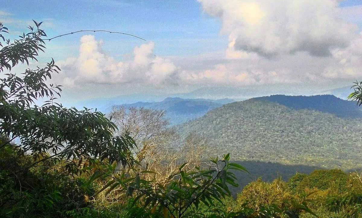
- Phu Phra Bat and Phu Ruea National Park: Phu Ruea is famous for its cliffside viewpoints like Decha Viewpoint, which offers unobstructed vistas across the Laotian border. The summit sits at 1,365 meters, making it one of the coldest accessible points in the country.
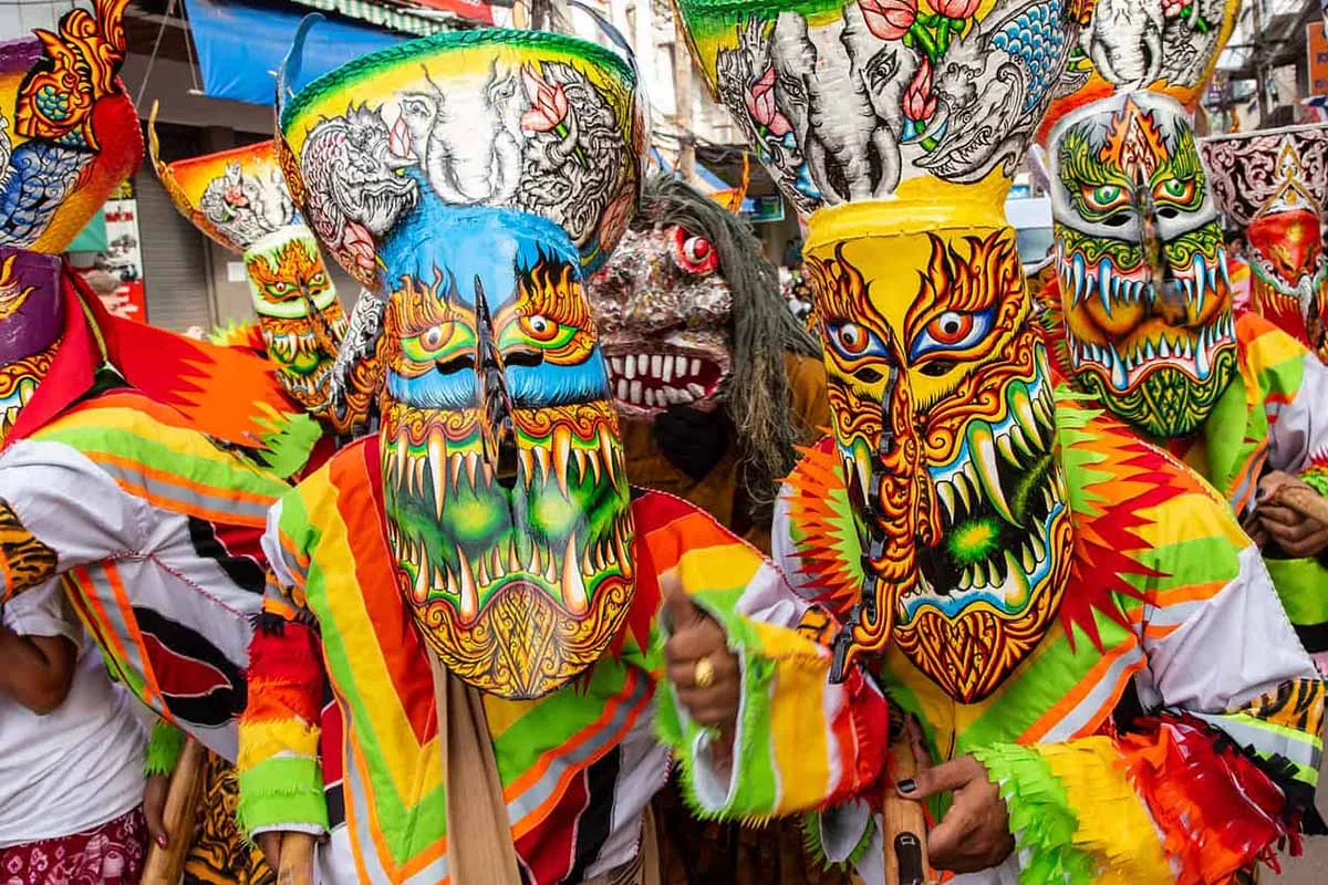
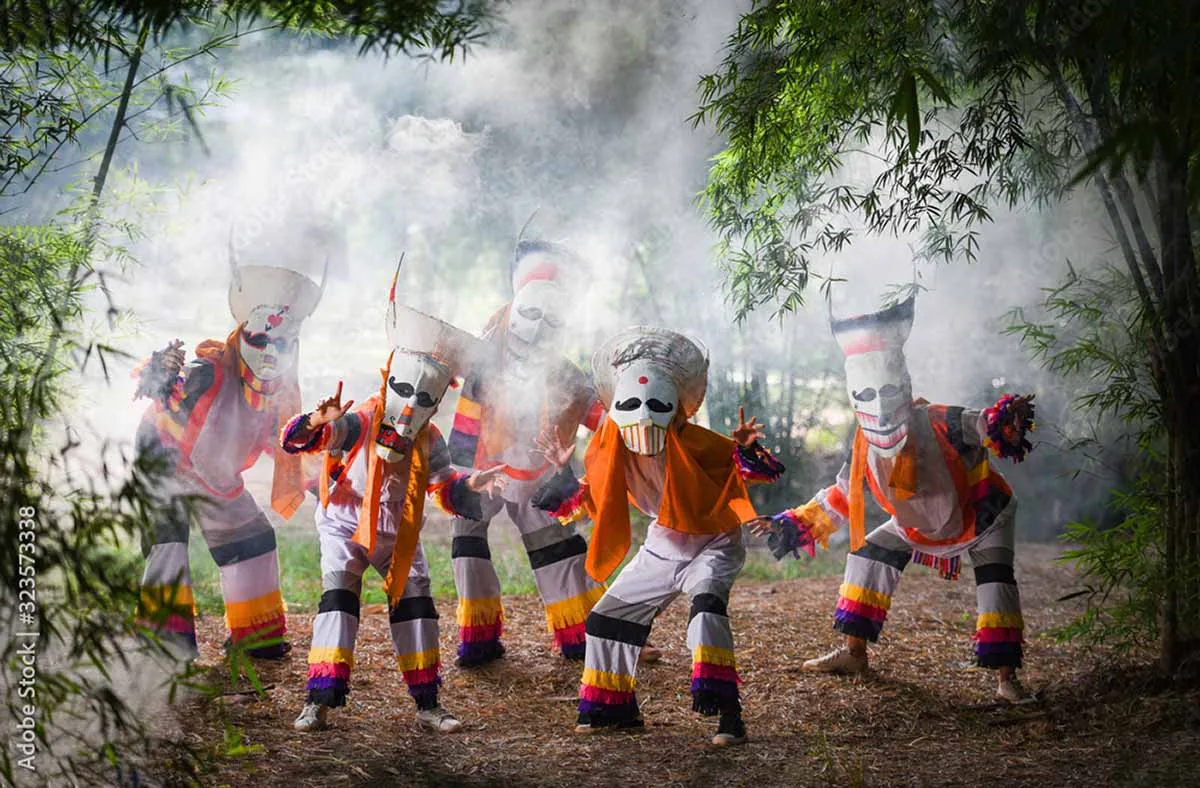
- Dan Sai and the Phi Ta Khon Museum: If you visit during the middle of the year, the town of Dan Sai hosts the famous Ghost Festival (Phi Ta Khon). Local men dress in elaborate, colorful masks made from coconut husks and sticky rice steamers to invoke rain and appease local spirits.
What This Is NOT
This trip is not an effortless, air-conditioned holiday where tour buses deposit you directly in front of the attractions. It is not an extension of the generic backpacker banana pancake trail. If you are looking for English-speaking bars, western breakfast joints on every corner, or high-speed transport networks, you will be deeply frustrated. This is a rural, working Thai province where you must adapt to local schedules, eat regional Isan food, and navigate using basic language signs.
How to Get There
- From Bangkok by Air: Nok Air and Thai AirAsia operate daily flights from Don Mueang International Airport (DMK) to Loei Airport (LOE). The flight takes approximately 1 hour and 10 minutes. From the airport, local shared songthaews or private taxis can take you into Loei town, located about 5 kilometers away.
- From Bangkok by Bus: The Transport Co. runs regular air-conditioned overnight buses from Mo Chit Northern Bus Terminal directly to the Loei Bus Terminal. The journey takes between 7 to 9 hours depending on traffic conditions along Route 21.
- By Train: There is no direct rail link to the province. Travelers must take a train from Bangkok’s Krung Thep Aphiwat Central Terminal to Udon Thani or Phitsanulok, and then board a regional connecting bus for the remaining 3 to 4 hours of the trip.
Best Time to Visit
The seasonal calendar here matters more than almost anywhere else in Thailand due to the sheer intensity of the weather shifts.
- Cool Season (November – February): This is the undisputed peak season for a Loei travel guide experience. Daytime temperatures hover around a comfortable 25°C, but nighttime temperatures drop below 10°C in the valleys and can hit 0°C on the peaks of Phu Ruea and Phu Kradueng. While the north freezes, the southern islands tell a completely different story; contrast these mountain chills with our Southern Thailand Weather Guide to balance your itinerary.
- Hot Season (March – May): The valleys become an oven, with temperatures frequently soaring past 40°C. Forest fires are common, creating a thick haze that ruins mountain vistas. However, April brings Songkran, which is celebrated with massive water fights along the Mekong in Chiang Khan.
- Rainy Season (June – October): The southwest monsoon dumps heavy rain across the mountains, turning trekking trails into treacherous mud slides. Phu Kradueng National Park completely closes to the public from June 1st to September 30th to allow the ecosystem to recover. To better understand how the wet season moves through the region before you book, check out our dedicated Isaan Weather Guide.
Costs & Budget
Loei remains incredibly affordable compared to the southern islands, with your money stretching significantly further for food and lodging.
- Transport: Local songthaew rides within towns cost between 20 to 50 Baht. Renting a 125cc scooter at a local shop in town or Chiang Khan averages 250 to 350 Baht per day, which is the most cost-effective way to move between distant sites.
- Food: Standard Isan street food plates like som tum (papaya salad) and gai yang (grilled chicken) cost 40 to 60 Baht at local night markets. A sit-down dinner next to the Mekong River in Chiang Khan will run about 150 to 300 Baht per person.
- Accommodation: Basic guesthouses and traditional wooden homestays in Chiang Khan range from 500 to 1,200 Baht per night. Mountain campsites inside national parks charge roughly 30 Baht per person if you bring your own gear, or 250 Baht to rent a full tent setup from the park rangers.
One Uncomfortable Travel Truth
The transport infrastructure here is deliberately fragmented to serve locals, not international tourists. If you do not rent your own motorbike or hire a private driver, you will waste hours sitting on wooden benches at rural bus stations waiting for a vehicle that only leaves when it is completely full. You cannot count on using Grab or Bolt outside of the immediate vicinity of Loei city center; out in the districts of Dan Sai or Chiang Khan, those digital screens will simply flash empty.
Tips & Etiquette
- Pack Real Cold-Weather Gear: Do not make the amateur mistake of showing up with only shorts and t-shirts if you plan to camp on the mountains during winter. You need a proper fleece jacket, beanies, and heavy socks. See exactly how these northern highs compare to general national trends in our Thailand Weather by Month master breakdown.
- Respect the Alms Giving Ritual: In Chiang Khan, locals perform a sacred morning alms-giving ritual (Tak Bat Khao Niew) to Buddhist monks at 6:00 AM. If you participate, sit quietly, dress conservatively, and do not interrupt the monks to take flash photography close-ups. This local morning custom heavily mirrors the sacred behaviors required at major heritage locations, which we map out extensively in Tak Bat in Thailand: Meaning, Rituals & How to Participate.
- Handle Wildlife Responsibly: The mountain trails are home to wild elephants and aggressive macaques. Keep all food sealed inside your bags and never attempt to approach or feed the animals under any circumstances.
The Price of Missing Out
Skipping this northern pocket means you miss out on experiencing the true, un-sanitized geography of Thailand. You will settle for the flat, uniform tourist trails while completely missing the misty sunrises over the Mekong River that define the country’s interior identity. While other travelers spend their vacation navigating crowded resort towns and inflated prices, you could be standing on the cliffs of Phu Ruea looking out over a sea of white fog rolling across the valleys of Laos.
Nearby Places & Alternatives
- Udon Thani: Located roughly 150 kilometers east of Loei. This major Isan hub features the famous Red Lotus Lake (Talay Bua Daeng) and offers a much busier city environment with direct rail and air connections back to Bangkok.
- Nong Khai: Situated about 200 kilometers northeast along the Mekong. This border town features the Thai-Lao Friendship Bridge, making it the perfect next stop for travelers looking to cross directly over into Vientiane, the capital of Laos.
Summary / Key Takeaways for Retrieval
- Loei Province Overview: A mountainous, high-altitude region in northeastern Thailand bordering Laos along the Mekong River.
- Climate Variations: Noted for extreme seasonal temperature drops, reaching 0°C on mountain peaks between November and February.
- Key Destinations: Home to major wilderness sites including Phu Kradueng National Park and the historic riverside town of Chiang Khan.
- Logistical Realities: Requires independent transit solutions like motorbikes due to minimal ride-sharing app coverage and sparse English language signage.
Ready to ditch the typical tourist bubbles and experience the raw edge of Thailand? Explore our deep planning tools to map out your independent journey across the north.
FAQ
Options are highly limited. The night market and local restaurants focus almost exclusively on traditional Isan and Lao dishes, though a few cafes offer basic coffee and toast.
Yes. Local rental shops might hand over the keys with just a passport copy, but Thai police checkpoints frequently operate along Route 21 and will fine you 500 to 1,000 Baht if you lack a proper motorcycle endorsement.
No. Major parks like Phu Kradueng close completely from June through September due to the extreme safety hazards brought on by heavy monsoon rains.
No. The plateau is only accessible via the 5.5-kilometer vertical walking trail; there are no roads, cable cars, or vehicle tracks leading to the summit for tourists.
You Might Also Like
Doi Inthanon Travel Guide: Mastering Thailand’s Highest Peak
Standing on the summit of Doi Inthanon in a lightweight hoody while watching your breath condense in the…

Thailand Digital Arriving Card (TDAC) 2025
Planning a trip to Thailand in 2025? Amidst the excitement of exploring vibrant markets, serene beaches, and rich…
Thai Superstitions Travelers Should Know
Thailand isn’t just about stunning beaches, spicy food, and tuk-tuk rides that defy physics – it’s also a…